Earthquake Information
Fault Name Index
A | B | C | D | E | F | G | H | I | J | K | L | M | N | O | P | Q | R | S | T | U | V | W | X | Y | Z
Faults of Southern California
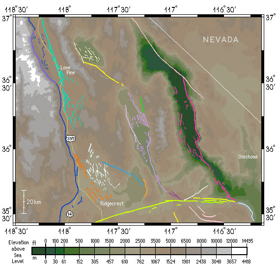
Basin and Range Region
Below is a map of the area east of and including the Sierra Nevada range front, extending well into Nevada. This area is the westernmost part of the geologic province known as the Basin and Range province -- characterized by roughly north-south trending valleys and mountain ranges, bounded typically by normal faults. Both the highest and lowest elevations in the state of California (and indeed, in the 48 contiguous states) can be found here. At the bottom of the map, a large fault marks a geological boundary between this region and the Mojave block to the south.