Earthquake Information
Chronological Earthquake Index
Imperial Valley Earthquake
TYPE OF FAULTING: right-lateral strike-slip
TIME: May 18, 1940 / 8:37 pm, PST
LOCATION: 32° 44' N, 115° 30' W 8 km (5 miles) north of Calexico 145 km (90 miles) east of San Diego
MAGNITUDE: MW6.9
FAULT RUPTURED: Imperial Fault
RUPTURE LENGTH: at least 40 km (25 miles)
MAXIMUM OFFSET: at least 4.5 meters (15 feet)
The strongest recorded quake to strike the Imperial Valley, the 1940 Imperial Valley earthquake caused at least $6 million in direct damage (not taking into consideration the crops lost due to damage of irrigation sysytems) and was directly responsible for the deaths of eight people, and, indirectly, for several others. At least 20 people were seriously injured. Damage to irrigation systems was so widespread that it is impossible to list it in detail. Rails were bent out of line in three locations where they crossed the Imperial fault, and several railroad bridges were damaged, both in California and Mexico. In California, the towns of Imperial, Brawley, El Centro, Calexico, and Mexicali were hit hardest, though the quake was felt as far away as Los Angeles (where it swayed tall buildings) and even in Tuscon, Arizona.
The Imperial fault broke through to the surface along at least a 40-km (25-mile) stretch, probably much longer (it was not well-mapped in Mexico). The northern end of the rupture was north of the town of Imperial, and continued along a south-southwest trending line into Mexico. Near El Centro, displacement was about 75 cm, and increased to 4.5 meters at the Mexican border. Near Cocopah, Mexico, the displacement was just over 2 meters. All these measurements represent nearly pure right-lateral slip.
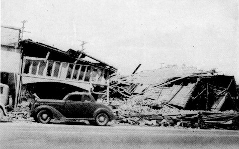
The collapse of these walls in the business district of Imperial
caused the deaths of four people. (Photo: U.S. Coast and Geodetic Survey)
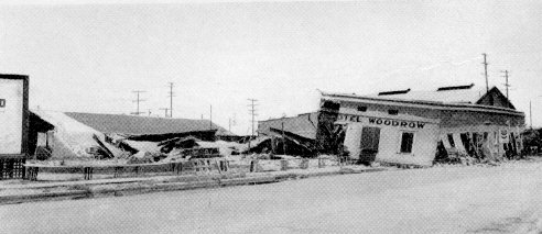
The second floor of the Hotel Woodrow in Brawley slid into the street when
the first floor collapsed in the shaking. (Photo: Franklin P. Ulrich)
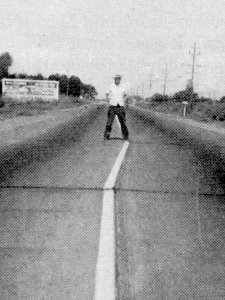
Right-lateral shifting of the roadway between Holtville and El Centro, showing a 76 cm (2.5 ft) offset. (Photo: H.M. Engle)
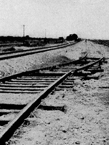
Right-lateral displacement of 2.13 meters (7 feet) along the Southern Pacific Railroad near Cocopah, Mexico. (Photo: Southern Pacific R.R. Co)
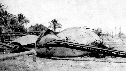
The collapse of the 100,000 gallon city water tank at Imperial. (Photo: U.S.C.G.S)