Earthquake Information
Southern California Earthquakes
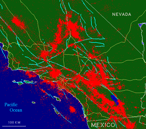
Seismicity for 1932-1996
The map below shows all recorded seismic events that have occurred in southern California in the years from 1932 through 1996, each quake represented by a single red pixel (many overlap). Plotted for reference on the background are the surface traces of the major faults in the area (shown as light blue-green lines -- the most prominent being the San Andreas fault, which runs from the lower right corner to the upper left corner of the map) and the major area highways (shown in yellow).
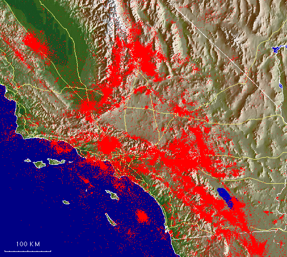
This map shows the same information, but on a relief-map background (without the fault lines). The seismic events are plotted for reference over a background relief map, with the major highways traced in yellow. Can you see the topographic expression of some of the major faults? Particularly easy to see are the San Andreas and Garlock faults.
To learn more about the faults of southern California, consult the clickable fault maps.
To learn more about the faults of southern California, consult the clickable fault maps.